|
Revue de Presse ou Sites Météo
REMONTEZ le TEMPS dans les ARCHIVES de METEOSOL! RLTAM Cumuls des Variations-J de la T° maxi CVJT
|
|
| INDEX ACCUEIL TABLEAU GLOBAL AGENDA FERRIES INHABITUEL CYCLONES
|
|
| SOURCES | COMMUNIQUES |
|
WU-Weather Underground 8 fév 2019
|
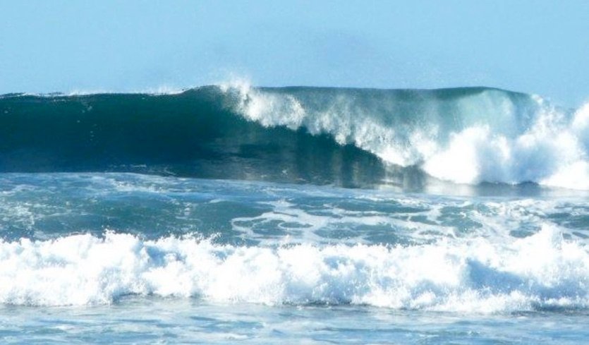
Hawaii : Huge Surf, High Winds, Unprecedented Coastal Flooding
An intense winter storm will approach Hawaii from the north this weekend—an unusual trajectory that could bring a variety of destructive impacts to the 50th State. The angle of approach will push very strong northwest to north winds across the islands. Extremely high surf can be expected, especially along north- and west-facing coastlines and harbors, where the National Weather Service is warning that coastal flooding could be “unprecedented.”
The most impactful part of this weekend’s Hawaii low may be the massive amounts of water that will be pushed toward Hawaii’s north- and west-facing shores. A separate storm well to the northwest will push long-period swells into the same region, adding to the problems. “Extraordinary large and disorganized surf will produce life- threatening conditions in the surf zone along north and west facing shores from this weekend into early next week,” warned the NWS in its surf zone forecast on Friday morning. Open ocean wave heights could exceed 60 feet off the north and west coasts, with wave periods as high as every 15 seconds, according to the most recent outlooks issued by NWS/Honolulu. “Those are very scary numbers for ships,” said Businger. "Fifteen seconds is a very short period for a 60-foot open ocean wave, meaning that these waves will be very steep and an extra hazard for shipping." The steep waves may also result in shoaling*, which could accentuate the near-shore wave heights. * élévation du fond de la mer
|